By Moreno Zanotto
“…and the award for outstanding achievement in innovation goes to...La La...oops...BikeMaps.org!”
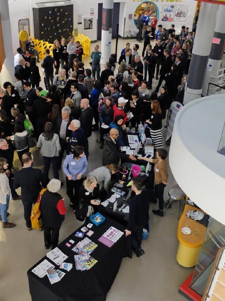 Photo credit: Ken Ohrn
February is award season, and last week was the ‘Academy Awards’ for cycling in Vancouver. On February 28th, HUB Cycling hosted its 4th Annual Bike Awards night at the Telus World of Science. HUB’s bike awards celebrate the contributions of individuals, organizations, municipalities, and schools that make cycling better in Metro Vancouver.
This year, HUB presented BikeMaps.org a bike award for demonstrating outstanding innovation to make cycling better in 2016. It was a great honour to be recognized by HUB, Metro Vancouver’s leading cycling organization.
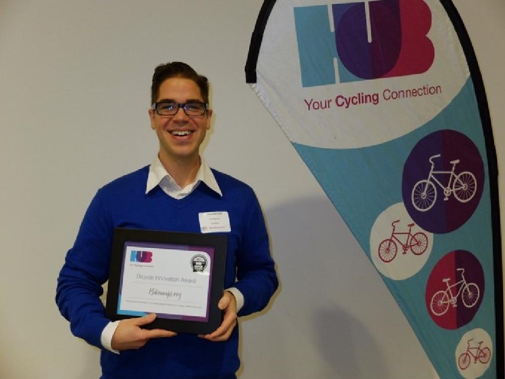 Photo credit: Ken Ohrn
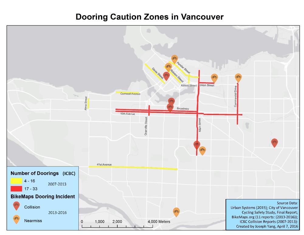
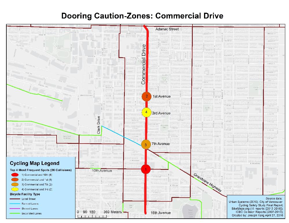
Over the past year, the citizen-contributed data collected by BikeMaps.org has helped make cycling safer in communities large and small throughout British Columbia. On Vancouver Island, the city of Victoria used citizen-reported data to plan the corridors for its protected cycling network, which has recently begun rolling out almost 3 kilometres of cycle track on priority streets in the downtown. Saanich, the largest municipality on Vancouver Island, has been using hotspot maps produced with BikeMaps.org data to assist project planners with prioritising upgraded cycling infrastructure. Four of the 20 hotspots identified have had improvements made and these were highlighted with the kickoff of Saanich’s Active Transportation Plan. Along the popular 10th Avenue bikeway in Vancouver, citizen ‘near-miss’ reports of conflicts with turning vehicles at Yukon street were shared to inform the design of a safer intersection. Fewer conflicts and close calls would mean safer travel for the almost half a million cyclists that cross this intersection every year.
Interest in BikeMaps.org continues to grow. In 2017, promotion will begin in Kelowna, Lethbridge, Guelph, and St. John’s. Internationally, groups in Reykjavik (Iceland) and London (UK) are encouraging cyclists to use BikeMaps.org to have better data in those locations for municipal planning and health research.
Visit HUB’s Facebook page to see more photos of the night.
_07_18_16.JPG)